Day 1: SF Bay Area to Tonopah, Nevada
I got off to an early start on Saturday morning. Well, actually, I had intended to leave Friday afternoon. However, by the time I got organized and ready to go on Friday, it was 5:00 PM. I didn't see the point of riding for only two or three hours before stopping for the night. So I went out for a leisurely dinner in Pleasanton and relaxed. With a good night's sleep and the bike already packed, I was ready to go when I awoke on Saturday.
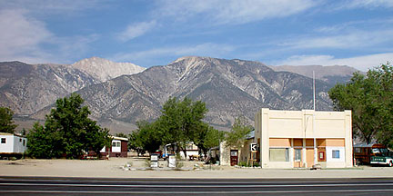
California highway 120, picked up south of Stockton, took me eastward across the Central Valley, through Yosemite National Park over the Tioga Pass, and finally south of Mono Lake to the town of Benton near the Nevada state line.
The photos below show views of Yosemite National Park from Tioga Road. The top photo looks over Yosemite Valley with Halfdome hidden behind the ridge at right. The two lower photos, shot from a viewpoint a bit farther along, show Halfdome across Yosemite Valley, and the view east along the road toward Tenaya Lake. You can almost make out the cables placed on Halfdome in summertime for the assistance of climbers. They run up and over the hump at the left of the main peak.


