Day 8: Hells Canyon to Lewiston and on to Moscow, ID
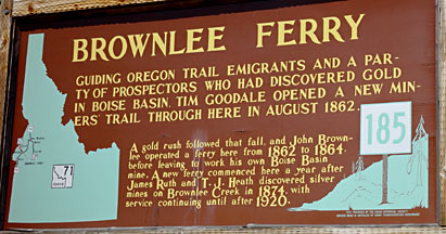
A quick breakfast at Macdonald's in Weiser, then I retraced my path on US highway 95 north to Cambridge, and turned west toward Hell's Canyon on Idaho route 71. The Snake River runs north through Hell's Canyon, dividing Idaho from Oregon and Washington, until it reaches Lewiston, where it joins with the Clearwater before running west through Washington state to join the Columbia. The highway meets the Snake River at the Brownlee Reservoir, then crosses to the Washington side at the Brownlee Dam. Brownlee reservoir is a beautiful recreation area offering camping, boating, horseback riding, and fishing. Surprisingly, this area was relatively uncrowded compared to the recreation areas along the Payette, north of Boise, through which I had passed the day before.
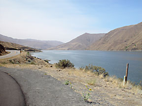
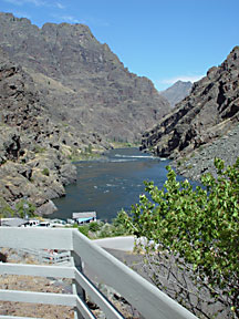
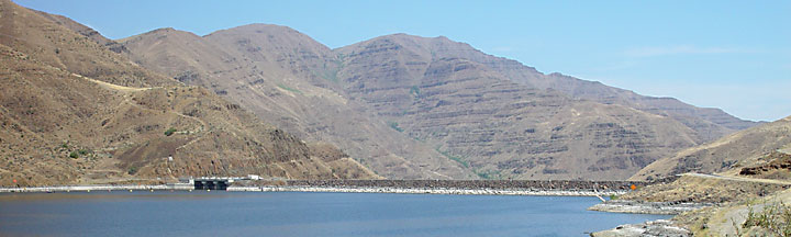
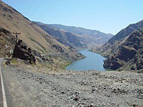
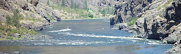
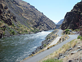
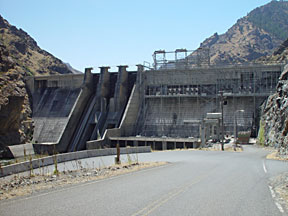
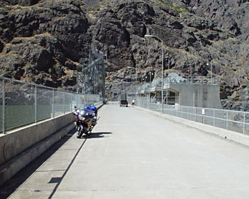
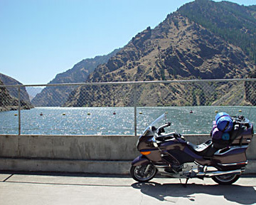
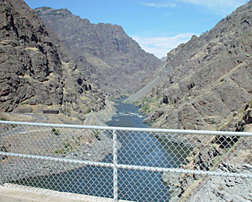
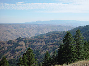
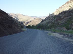
There are three dams on the Snake River as one proceeds northward toward the Hell's Canyon National Recreation area. The Brownlee Dam is the southernmost. Proceeding north, I crossed eastward again over the Snake just past the Oxbow Dam. An excellent motorcycle road then winds along the east bank of the Snake River about 14 miles north to the Hells Canyon Dam. There were powerboats and waterskiers on the river. The two lane highway dead-ends just past the dam, and the only way out is to ride the same 14 miles back, but the views and the curves are worth the trip. There was little vehicle traffic on this road.
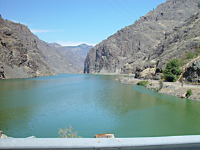
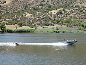
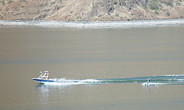
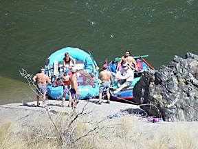
There is an information center just north of the Hells Canyon Dam. If you have time you can take a powerboat trip on the river through Hells Canyon, at 5500 feet said to be the deepest river gorge in North America. I watched the powerboat shooting the rapids north of the information center and took some photos. River rafting is also available, and I took pictures of a group about to embark.
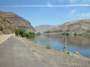
The road crosses over the dam, then runs a short distance north along the west bank to the information center and boat-launching ramp.
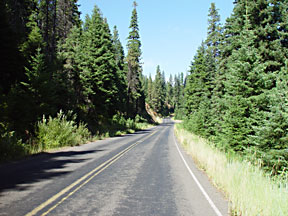
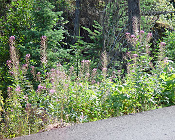
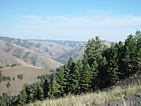
After back-tracking south to the Oxbow dam, I followed route 39 through the Hell's Canyon Recreation Area on the Oregon side to Joseph and Enterprise. The road follows North Pine Creek through heavy forest. I stopped to take in the view at Hell's Canyon Overlook and also to photograph some flowers along the road that I thought were especially pretty.
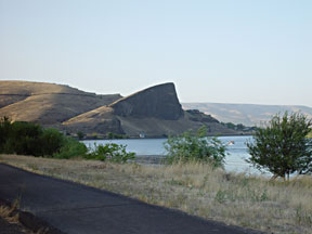
Oregon highway 3 north from Enterprise, Oregon, passes through some nice farmland and then through wilderness from the Wallowa-Whitman National Forest becoming Washington route 129 north to Clarkston, Washington and Lewiston, Idaho. The road was in process of being resurfaced using the old pea gravel and tar routine, which made for some pretty slow and dusty riding, especially through the switchbacks in the national forest. I was happy to see signs of civilization and the impressive monolith as I approached Lewiston.
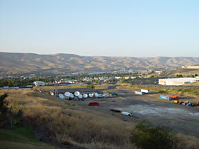
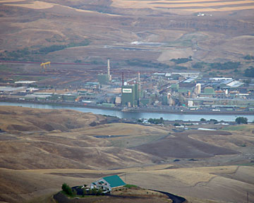
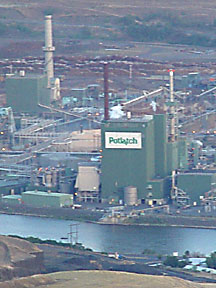
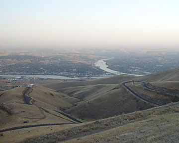
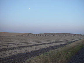
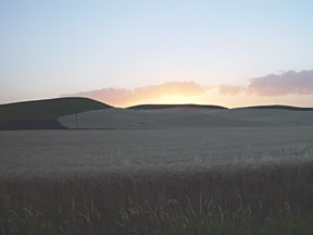
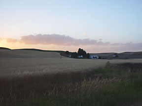
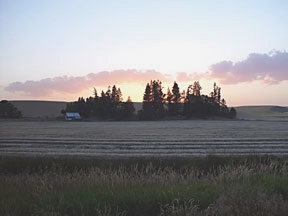
I crossed the Clearwater River in Lewiston and rode north toward Moscow, Idaho, a lively college town, where I spent the night. US Highway 95 climbs steeply north of the river and offers dramatic views of the city of Lewiston, Idaho, and its smaller neighbor to the west, Clarkston, Washington, as well as the junction of the Clearwater and Snake rivers and Lewiston's major industrial facility, the Potlatch Corporation. In the 20 miles or so around Genesee, Idaho, and north to Moscow, US 95 passes through the most beautiful grain-farming region I have ever seen. I was so impressed by this farmland that I took a short side trip on US 95 when I returned to Lewiston two days later to take more photos.
Return to 2002 trip map.